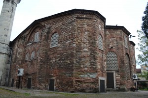
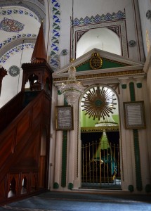
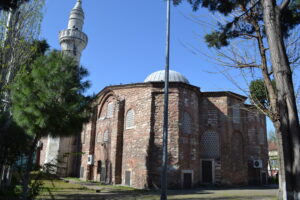
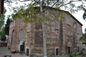
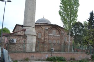
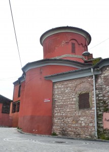
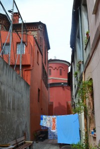
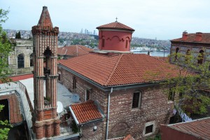
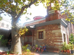
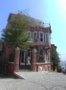
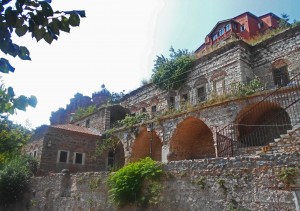
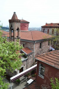
It’s probably not the Church of St Peter and St Mark but nobody agrees on an alternative. It’s a rather nice mosque right at the end of the Golden Horn walls near the Blachernae Palace (or what’s left of it). 41°02′18.96″N 28°56′38.40″E Apparently, a church was founded here in 458 but this is not it. The main structure seems to date from the late ninth century. Unusually, there is a tomb inside the mosque; that of Cabir, killed with the great Eyüp in the Arab siege of Constantinople in 668.
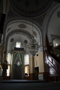
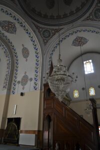
The building must have had a hefty reconstruction as the mihrab fits perfectly in the focus of the church. Still, it’s a nice place and the gardens are pleasant.
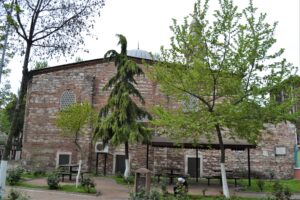
This is a view of the church from the south-west in 2016. Note the polygonal exteriors of the apses as well as the unusual recessed stonework where the left-hand apse meets the south wall.
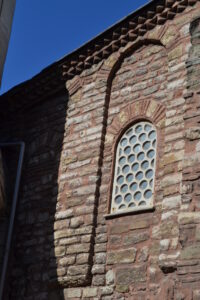
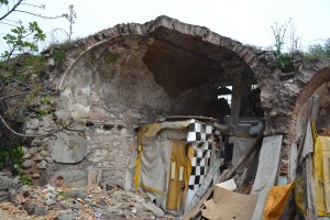
This view shows how much the stonework has changed. The window extended further down. The partial arch at top left shows that there was once a similar window to the left. It was probably bricked over when the minaret was added in the conversion to a mosque. Many of the original windows are now covered. This church must have been much brighter inside in the 10th century.
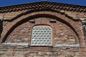
This brickwork has some interesting features. The nice roofline is Byzantine but some Byzantine flourishes survive on either side of the window.
This is a domed-cross church, a precursor of the. four-column church that became popular later. Van Millingen tells us that the piers and dome arches are original.
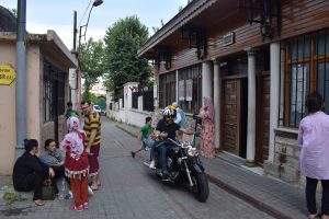
This view of what would be the northern side of a conventional east-west oriented church shows the Byzantine wall (on the right) of a narthex. The remainder of the narthex has been replaced by a wooden structure.
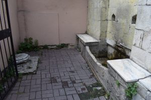
The Byzantine well still exists and feeds the modern şadırvan, the descendant of the ayazma.

Posted June 27, 2014 Posted by Adam in Uncategorized
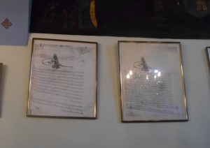
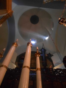
This is a fortress of a place, probably necessary for it to have survived relatively intact as a working church from Byzantine times to today. It is the only one to have done so. On its wall, it has a copy of the decree of Sultan Mehmet II, conferring the right to retain the building as a church. The original is presumably safe in a vault somewhere. The Mouchliotissa used to be a regular shape with a dome supported by four cupolas, the same sort of plan as the major mosques. However, the depredations of time, fire and town planning have removed parts of it and added others. The church of the Blessed Virgin Kamariotissa on Heybeliada is of a similar design but has been protected by its island position and by nestling within the protective walls of the Turkish Naval School (formerly the Greek Commercial School).
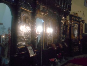
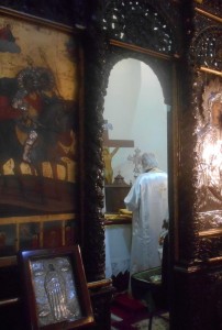
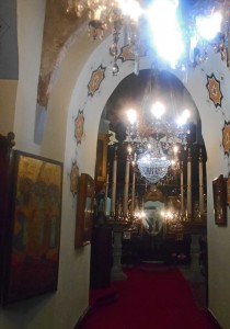
The decoration inside is unlike that of any other church in Istanbul. The caretaker says that the iconostasis is unchanged from Byzantine times. The aged paintings, especially those in the top row of the iconostasis, repay close examination. The symbolism seems deeper than anywhere else. One mosaic icon and some paintings are probably original, from Byzantine times. There is an underground passage that is said to lead to Aya Sofya. but if all the rumours of tunnels to Aya Sofya were true, Constantinople must have had a superb Metro system.
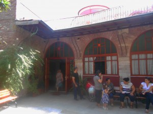
The Church was allegedly founded in the late 13th century by an illegitimate daughter of Michael VIII Palaeologos who had been packed off to the east to hold off a rampaging Mongol warlord by marrying him. However it seems to have been in existence since 1261, well before her return from the bliss of conjugal diplomacy. Apparently, her experiences were sufficient to cause her to renounce worldly pleasures and she remained in the church convent until she died. At the moment, the church is painted an uncompromising red to match its Turkish name of Kanlı Kilise (Bloody Church). The fighting at The Conquest or The Fall (depending on your point of view) released a lot of blood at this point in 1453.
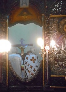
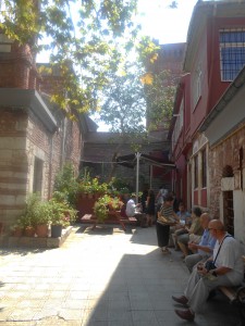
If you want to find this church, be aware that Google Maps has placed it on the site of the big Greek school that is nearby. These coordinates (41°01′47″N 28°56′56″E/41.029722°N 28.948889°E) are correct. The church has services at irregular intervals, the irregularity increasing in the summer months. The Name Day for both Mary and Theotokis is August 15th. This may be your best chance to see a Byzantine church in action. The following pictures were taken on that day in 2014.
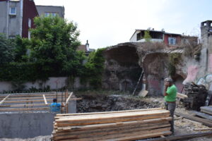
There is some interesting ruined vaulting on the uphill side. Local children may cheer you on (as they did me) as you clamber on it to gain an aerial view of this most resilient of churches.
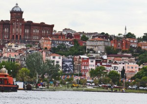
Position of the Mouchlitissa (centre) compared with Fethiye Camii (top right)

Posted June 25, 2014 Posted by Adam in Uncategorized
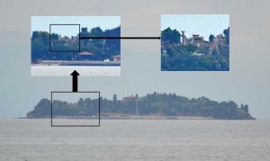
On an island a few hundred metres off the coast of Tuzla are the well-preserved remains of the Byzantine Church of St. Glykeria (Hagia Glykeria Nesos, 40.791212,29.274938). However, the island is owned by Rahmi Koç and this limits access somewhat. The island may once have been called Incirli Adası but now is invariably called Koç Adası. There is some information here.

Posted June 25, 2014 Posted by Adam in Uncategorized
This may be Istanbul’s most significant archaeological site. It is primarily of interest for its evidence of hominid settlement in the Pleistocene and there has been a lot of study of the cave bear bones found inside, especially their relationship with Palaeolithic weapons that might have killed them.
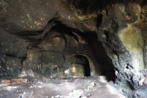
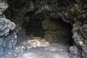
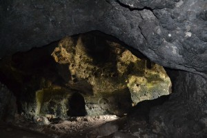
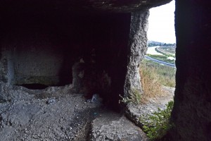
Human habitation continued until Byzantine times and there is a church cut into the rock in the upper cave. This is superficially similar to the Aya Nikola Monastery in Kıyıköy and Mamboury advances the idea that this was a church of St Theodore. The whole place is a minefield of archaeological argument but it is a wonderful place to explore. The protection of the iron grilles installed to prevent people entering is minimal as the gap between bars allows even me to enter, let alone those with the more lean physiques normally associated with youthful vandalism. However, the main damage has been done by film crews for whom this is a common location. Yusuf and Emir, the young guardians of the cave, listed a Who’s Who of Turkish actors whom they had seen filming here. They told me the legend of the tunnel in the lower cave that allegedly goes all the way to Topkapı Palace. It goes about 600m (in roughly the right direction, admittedly). There were once some spectacular wall paintings there that did not survive until the 21st century.
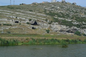
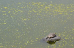
Across the Sazlıdere River is another cave belonging to the same settlement. There is little of importance here, but the grilles are much more secure. The river itself appears polluted but the old car tyres are favoured by a large population of turtles which like to sun themselves on them.
The access situation has changed as of September 2016. The grilles have been repaired and not even small boys can get through. I arrived at the site and almost immediately a Zabita van from Başakşehir Belediyesi arrived. Three uniformed policemen got out, shook my hand and unlocked the gate to the cave. Apparently, you can call 444 0 669 and someone will come and let you in. The advantage of this is that vandalism and treasure-hunting excavations are no longer destroying what is left in the cave. The downside is that you can’t stay in the cave for very long and extended exploration of the long tunnel with its bats and calcite formations will now require tedious official preparation.
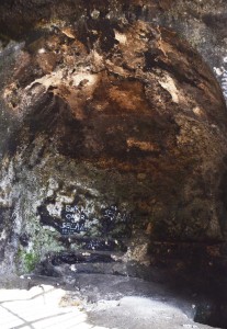
Apse with synthronon of church near entrance of upper chamber
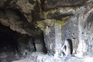
South wall of upper chamber showing extensive Byzantine remains
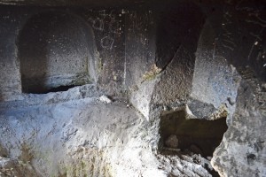
Necropolis with three large burial chambers about 12m above the main chamber
View south from necropolis along Sazlıdere towards Küçükçekmece
Arsebük, G., F.C. Howell, S.L. Kuhn, W.R. Farrand, M. Özbaşaran, M.C. Stiner. (2010) Chapter 1: The caves of Yarımburgaz: Geological context and history of investigation. In (Howell et al., Eds.) Culture and Biology at a Crossroads: The Middle Pleistocene Record of Yarimburgaz Cave (Thrace, Turkey). Zero Books/Ege Publications, Istanbul, pp. 1-27. Available online at: https://www.academia.edu/969121/Chapter_1_The_caves_of_Yar%C4%B1mburgaz_Geological_context_and_history_of_investigation Accessed Sept 1 2016(2010)
Arsebük, G., F.C. Howell, M. Özbaşaran, (1998) Yarımburgaz “1988” in XI Kazı Sonuçlar Toplantası I. T.C. Kültür Bakanlığı Anıtlar ve Müzeler Genel Müdürlüğü pages 9 – 38 Available online at: http://www.kulturvarliklari.gov.tr/sempozyum_pdf/kazilar/11_kazi_1.pdf Accessed Sept 4 2016
TAY Project (2000) Yarımburgaz Mağarası. The Archaeological Settlements of Turkey. http://www.tayproject.org/TAYmaster.fm$Retrieve?YerlesmeNo=2826&html=masterengdetail.html&layout=web Accessed Sept 4 2016

Posted June 25, 2014 Posted by Adam in Uncategorized
There is a large expanse of farmland on the north-east coast of Küçükçekmece. This is an oasis in the proliferating forests of giant apartment blocks in other districts surrounding the lake and probably remains as it is because it is owned by various government institutions, especially the veterinary faculty of Istanbul University. This is slightly odd because the area operates as a grain farm and I saw no animals at all.
I am not sure whether or not I was allowed in. One has to go through two automated gates to enter the archaeological site (41.032913,28.734226). I went at harvest time. The gates were probably open to allow the monstrous combine harvesters in. On my way out, the gates were closed. I got out of the car to look at them and an unseen presence in the nearby buildings opened them for me.
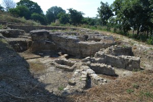
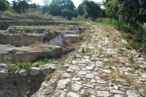
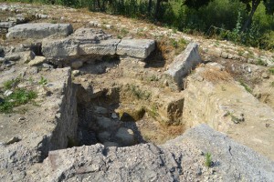
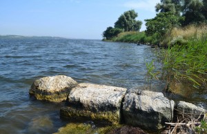
It’s a big site and only partially excavated. A Scientific American article gives some detail. It seems to have thrived between the 4th and 11th centuries. An earthquake ended its importance. Its long sea wall is largely submerged, as are a lot of remains of the city. Bathonea is almost certainly not the correct name, although a more accurate candidate is yet to surface. At present, the site seems to be deserted except for the most enormous toads.

« Previous Entries Next Entries »
