
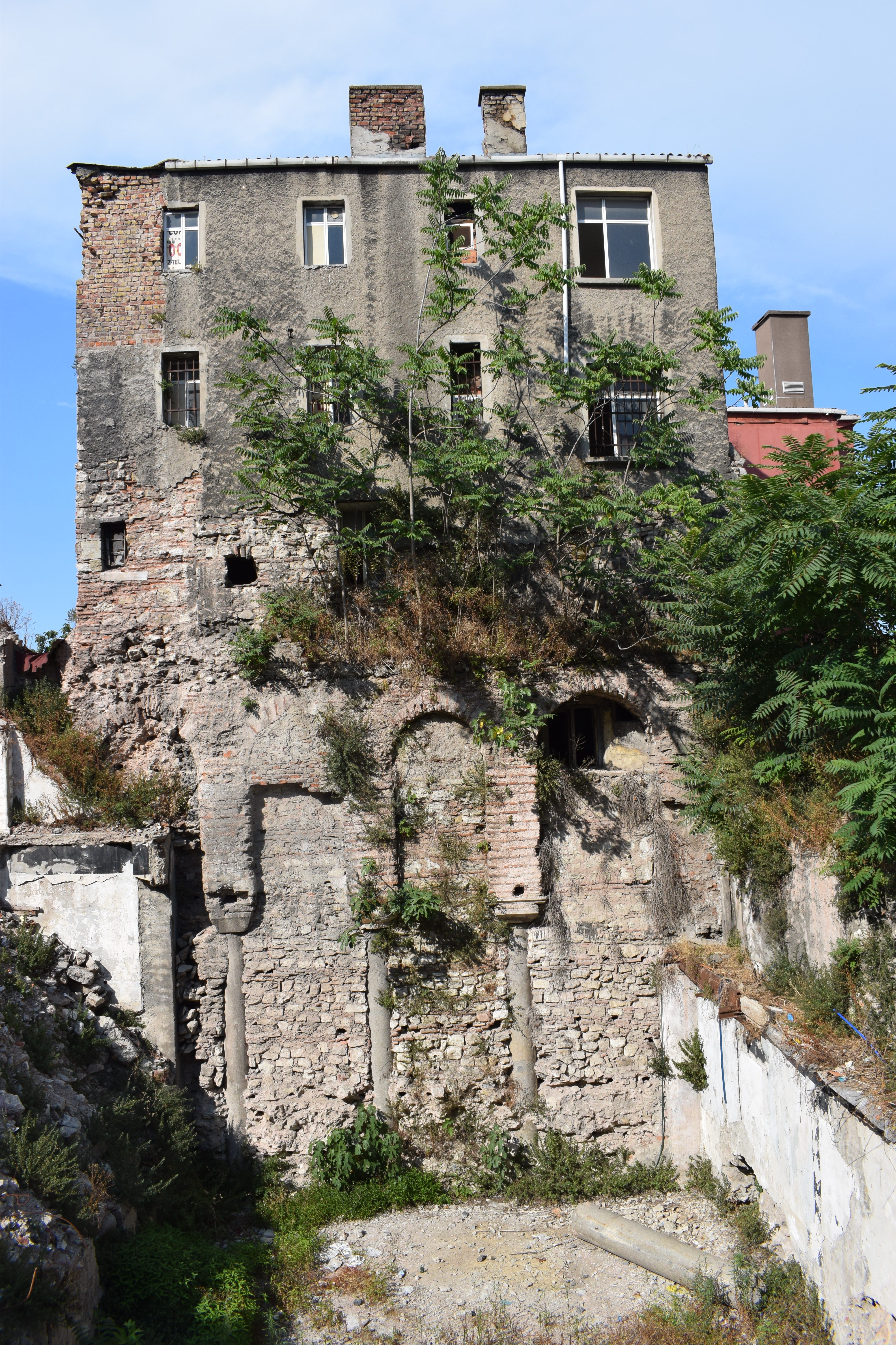
Unmistakable Byzantine section
I became aware of this building from Trici Venola’s site at this web address. The post doesn’t seem to work now; probably an attempt to protect the location of a Byzantine chapel to which it made specific reference. However, in early July 2019, it referred to a pink-plastered building coming down and exposing what we can now see in the top photo. It’s in Günaydın Otopark at 41.010353, 28.976887, on Alayköşkü Caddesi, a street in which Byzantine stonework keeps spilling out from behind crumbling modern stuff.

Some Byzantine arches on Alayköşkü Caddesi
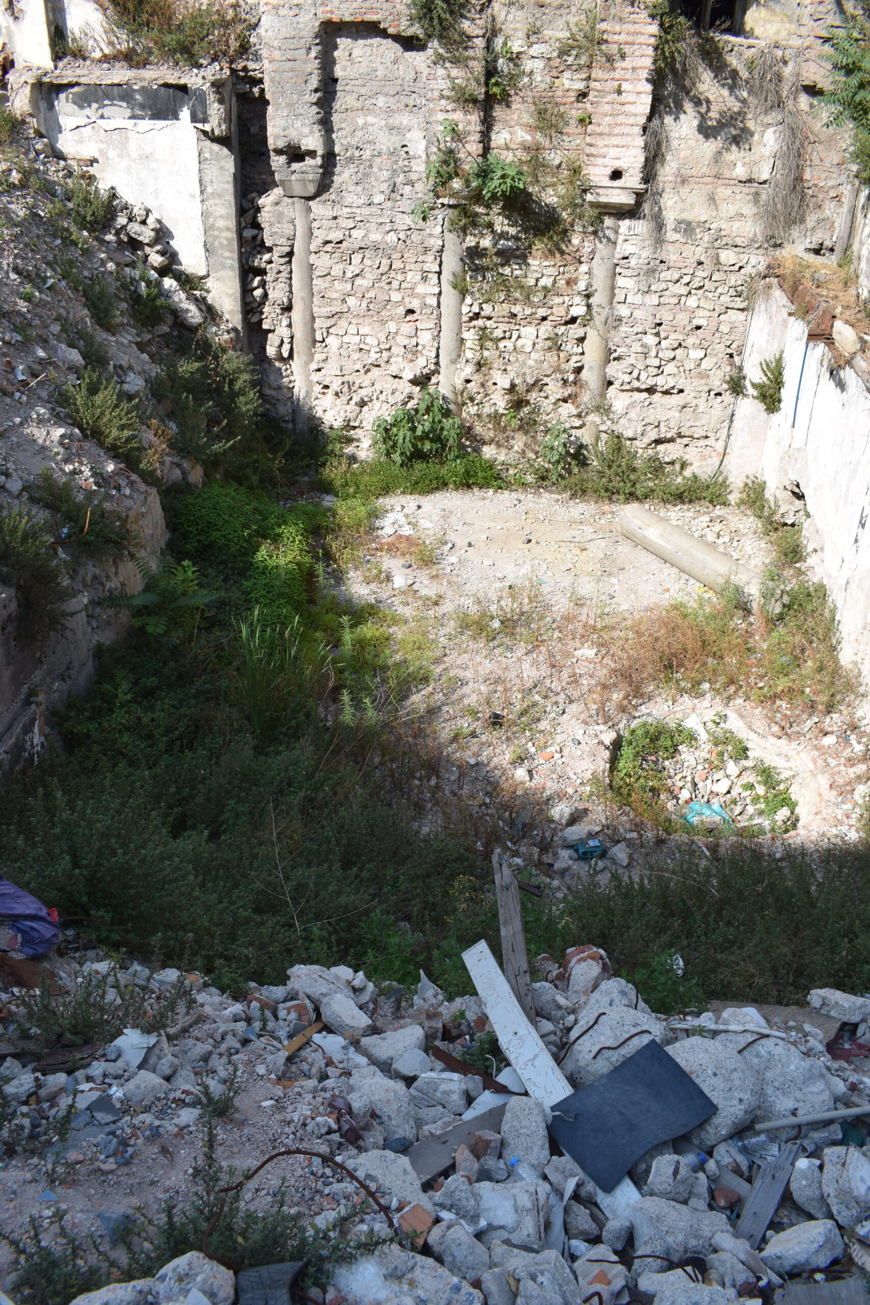
One steps into the carpark, looks to the left and a wall of Byzantine revelation appears.
Composite wall of the site
It is a microcosm of Istanbul – layer on layer of stonework of steadily rising youth. the top is inevitably a nondescript dwelling. The bottom is a lovely slice of Constantinople and I got a bit overexcited when I saw it, attempting to map out the structure of a church from the exposed section. It has since been pointed out that it is a cistern. Of course it is. It’s too deep to be anything but.
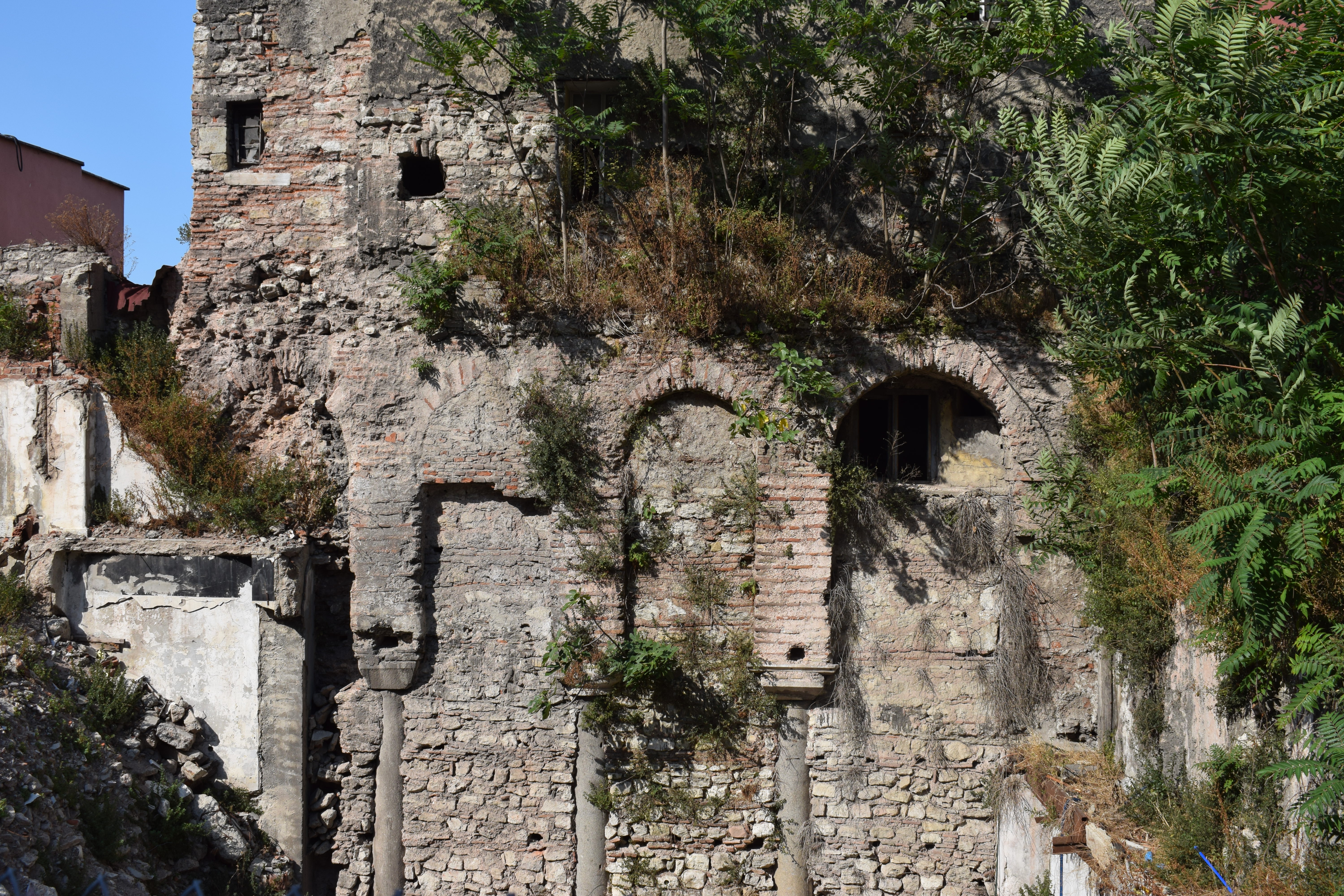
Layers of Byzantine, Ottoman and Republican era brickwork
This site has undergone a good deal of use over its thousands of years of habitation. The recent excavation appears to have opened a cross-section of the cistern. The column lying in front of the standing wall hints at the size of the structure that once stood in the now empty space.
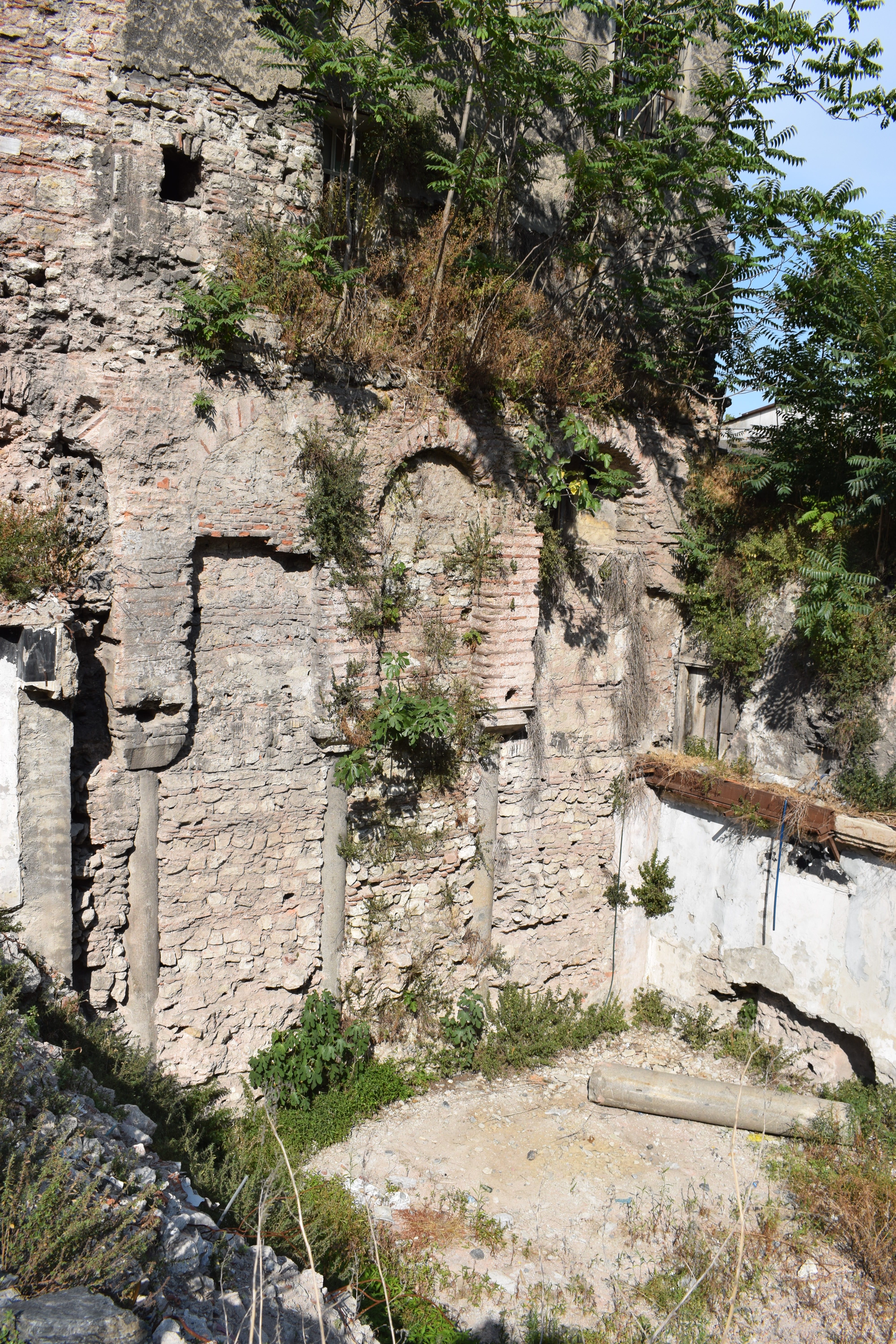
Other columns have probably been incorporated into nearby buildings
It looks as if much of the cistern was demolished a long time ago. The height of the arches above the column capitals is remarkable. All three of the column capitals exposed in this section are distinctly different. The standing column to the left is longer than the other two. Presumably, they were reused from pre-existing buildings.
Unusual height of arch above colonade
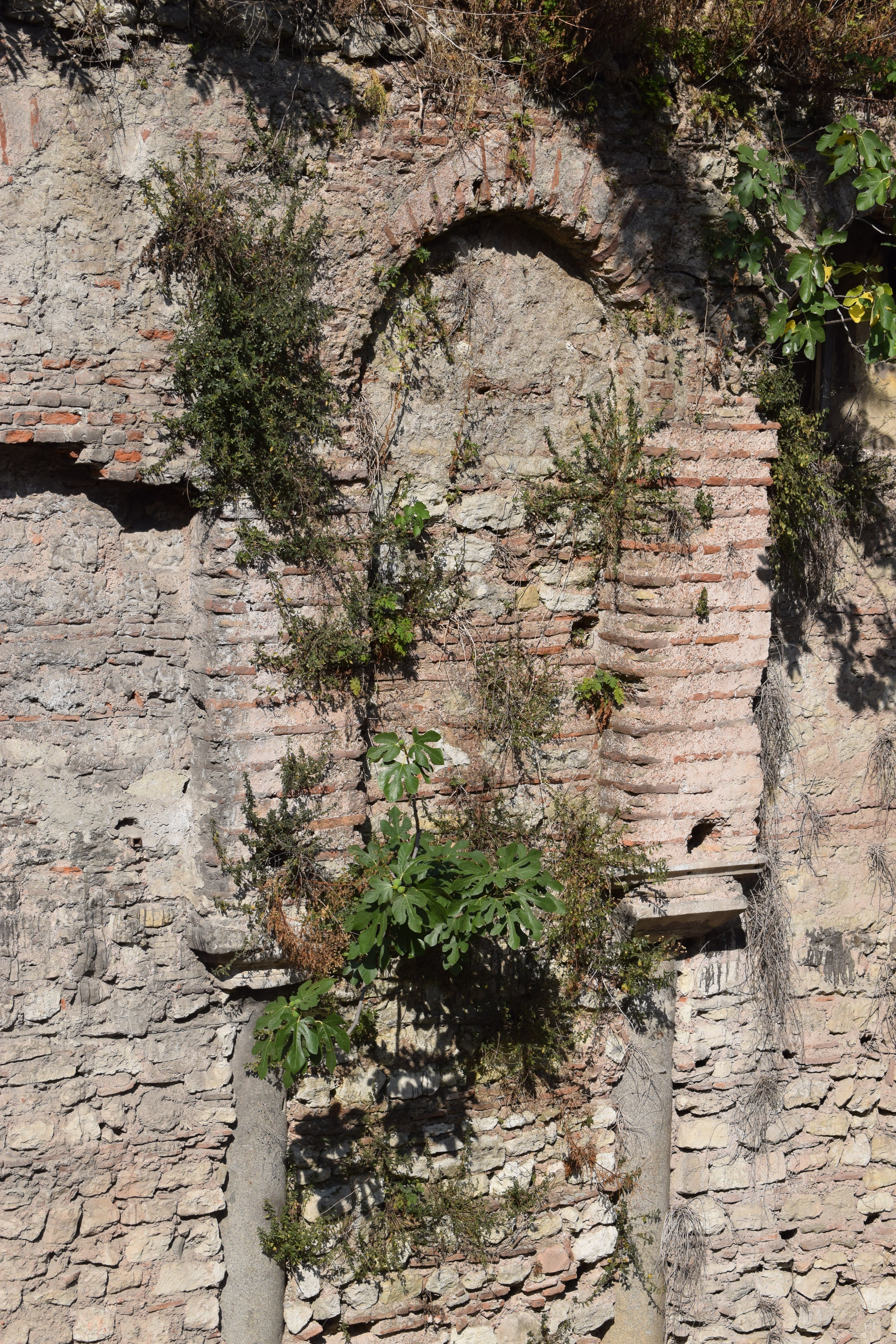
There is some fine stonework in this structure. That central arch shows some real delicacy, despite a bit of rough patching at some stage in its history. This cistern was close to the Church of St Mary Chalcoprateia, perhaps close enough to be part of the complex of buildings once associated with this prestigious church.
It will be interesting to see what happens to this site in the next few years.


Posted June 23, 2019 Posted by Adam in Uncategorized
Treasure-hunter activity visible at the bottom of the photo
Posted May 28, 2019 Posted by Adam in Uncategorized
Inside chapel looking west
Posted April 27, 2019 Posted by Adam in Uncategorized
Posted February 6, 2019 Posted by Adam in Uncategorized

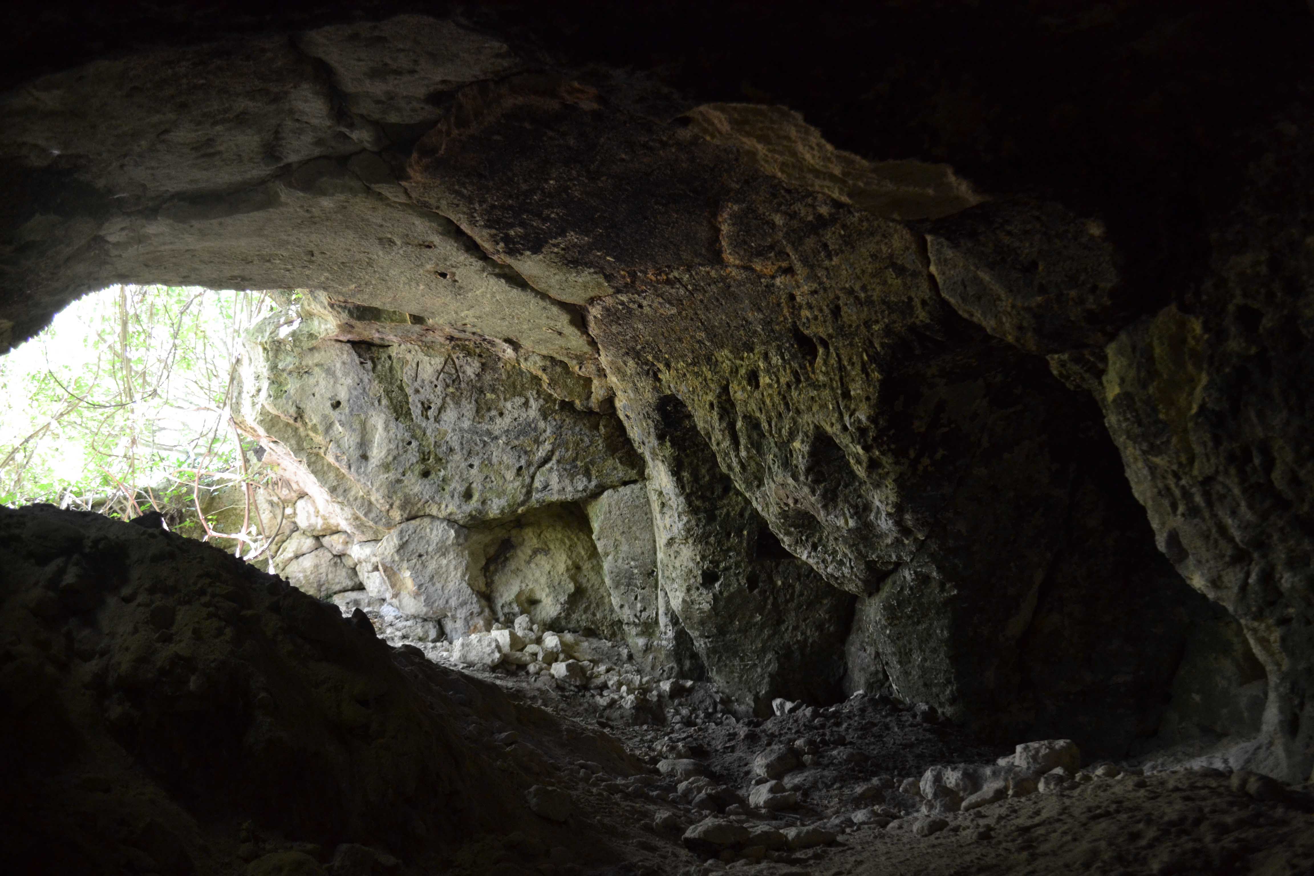
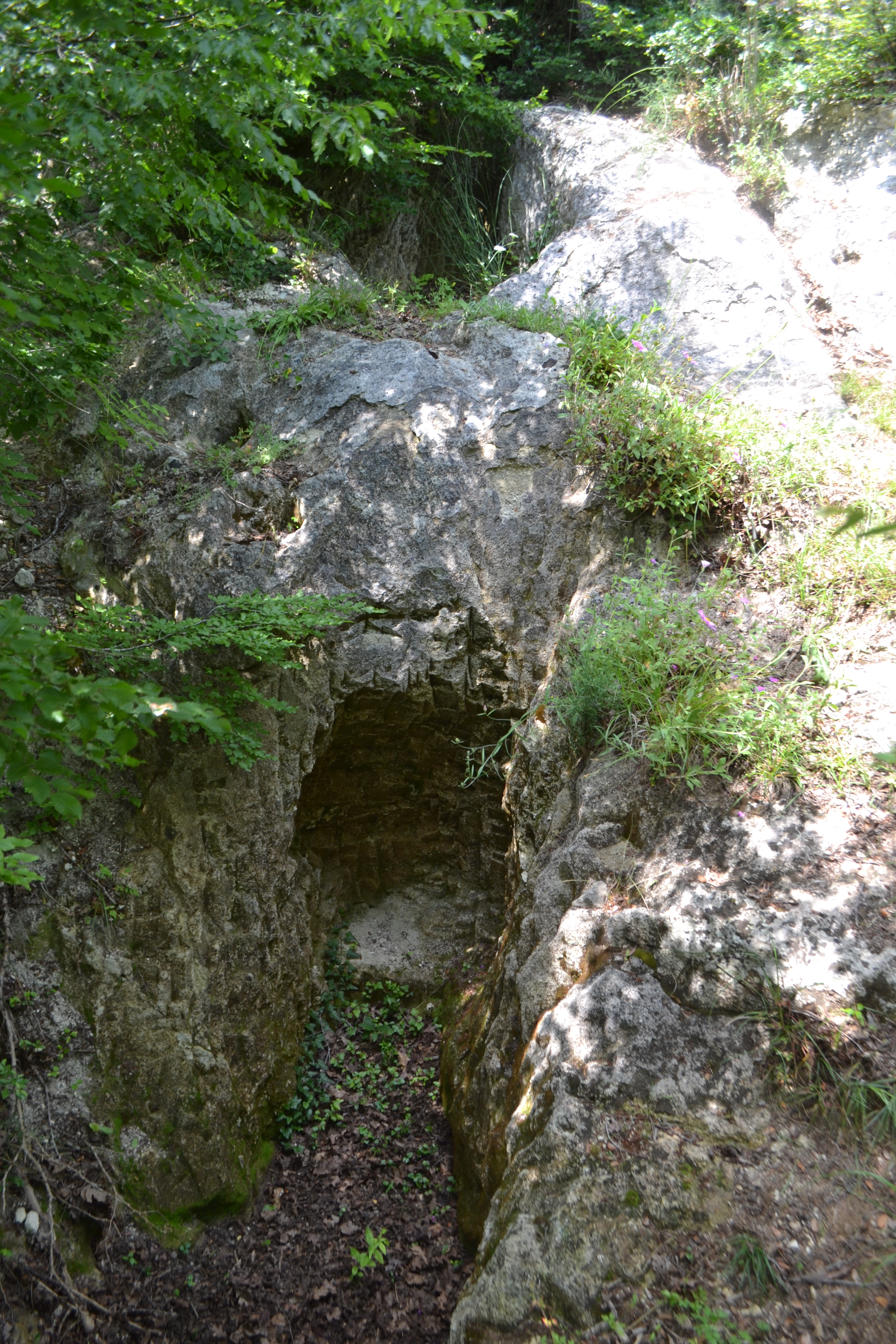
View of the chapel from the southern entrance
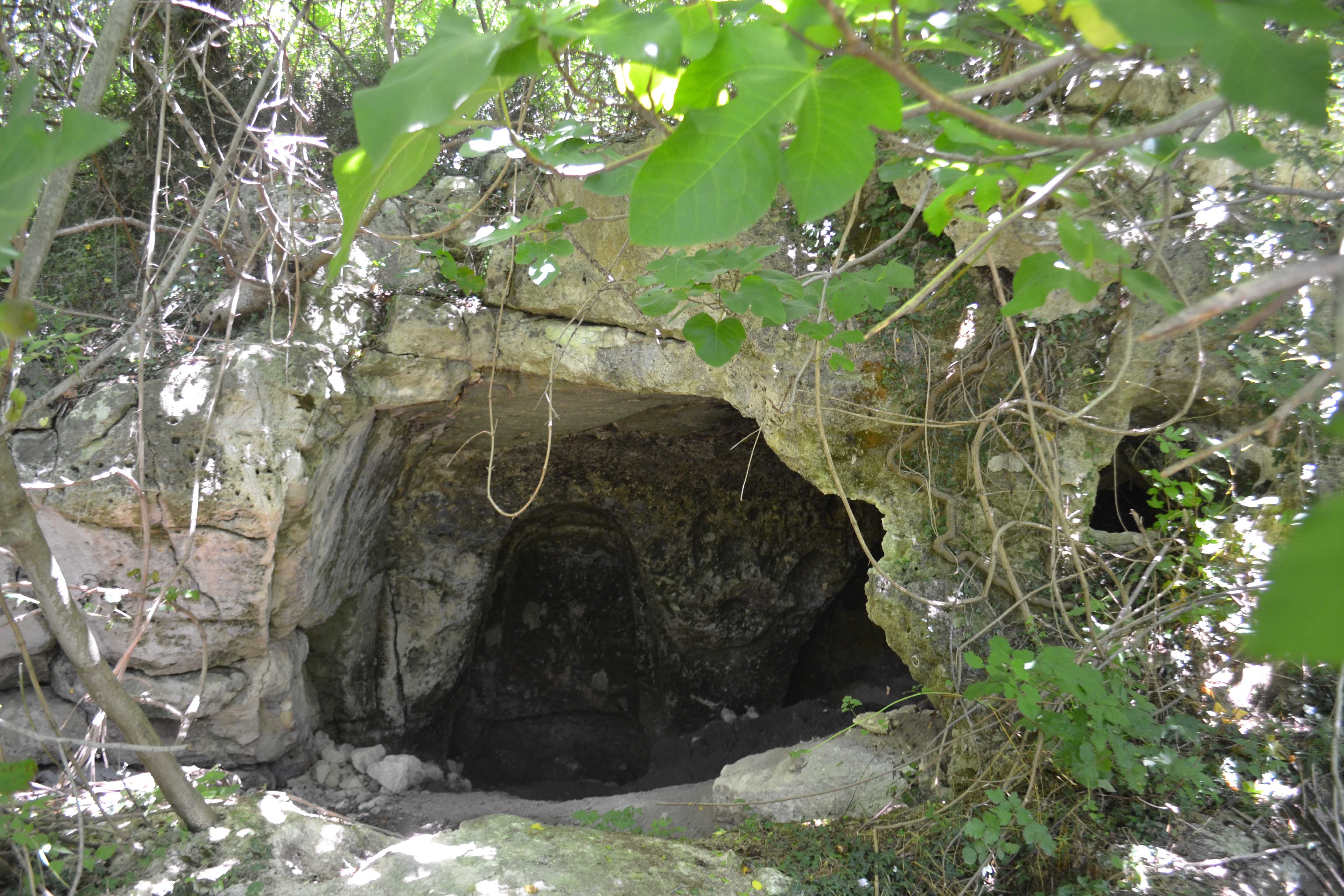
There must have been a holy precinct extending west from the city of Midye (now Kıyıköy) in the 6th century. 500 metres east of the Çalışkan Farm cave church and a kilometer west of the Aya Nikola Monastery lies a field of roughly carved rock graves – a necropolis. In the centre of these is what may have been the funerary chapel(41.629434875276, 28.068034333229) .

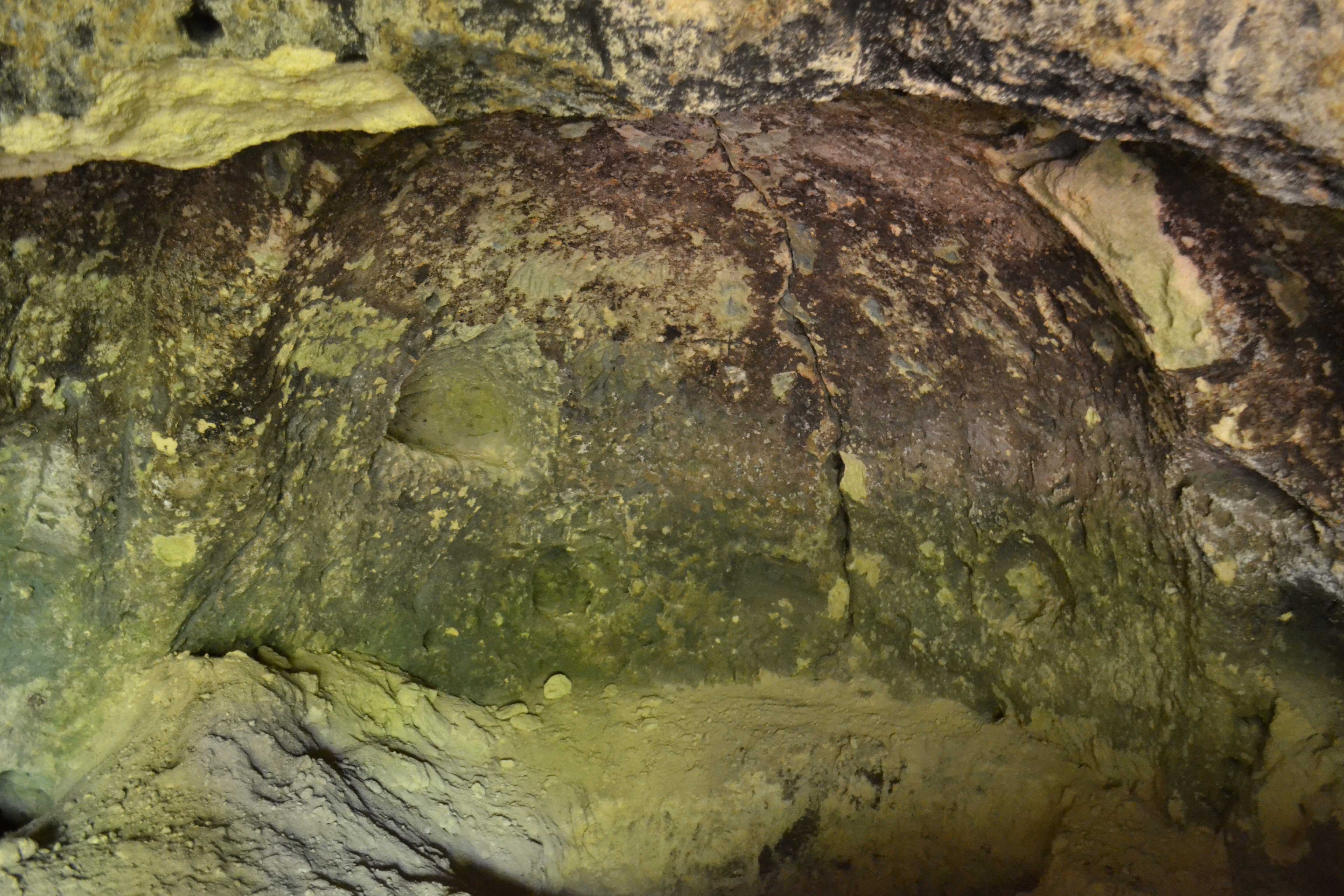
This view of the niche in the northern wall shows the marks of treasure hunters’ tools
It is a small structure, accessed by an opening to the south and about three metres along its main east-west axis. It is about 1.5 metres high, not enough height to allow standing room. It is probable that this was an intricate grave rather than a chapel, but the carved fixtures do not seem to allow sufficient space for a body or bodies to have been placed within.
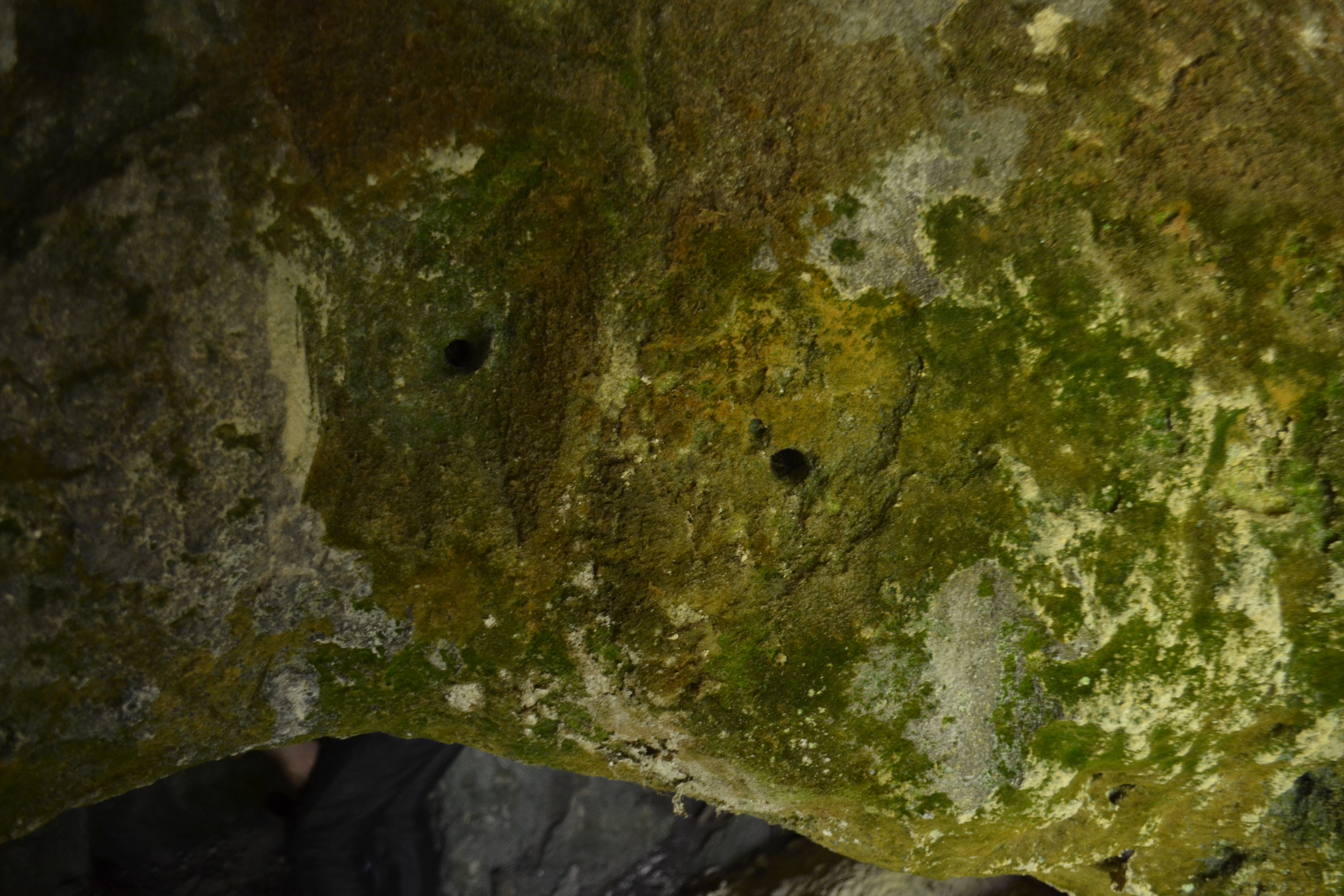
Evidence that metal fittings were once held in place above the entrance
For a while, this structure was augmented by a concrete slab roof, enabling it to be used for farm storage. The concrete is now gone. There is evidence that treasure-hunters have tried their luck here but realized fairly quickly that once they started digging into bedrock, their chances of finding treasure were zero.
One of the areas of graves to the west of the chapel
The rock face, only about 30m from the main Kıyıköy – Vize road, is honeycombed with graves. These are all eroded as one would expect from a thousand years of limestone weathering.
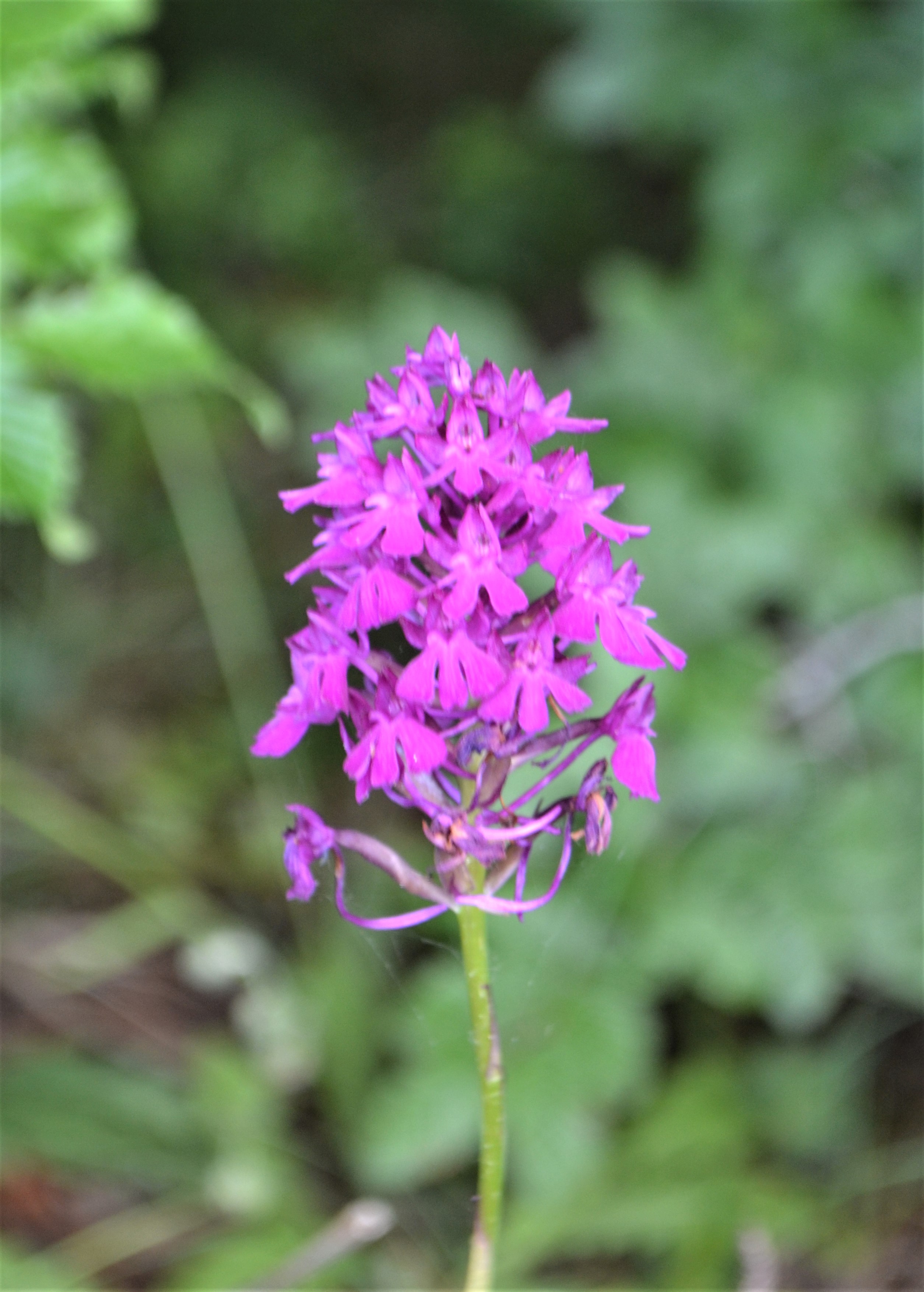
A pyramid orchid from the necropolis area
The coastal heathland around the necropolis is home to some interesting seasonal flowers. In early summer, the pyramid orchids are in flower.
Civelek, E. (2016) Kıyıköy Şarapçı Yolu Kaya Oyma Mezarı. Kırklareli Kültür Varlıkları Envanteri. available online at: http://www.kirklarelienvanteri.gov.tr/anitlar.php?id=88 Accessed 5th February, 2019
« Previous Entries